Hiking in Iceland — Complete Guide
Iceland’s trails cross lava deserts, mossy valleys, glaciers, sea cliffs, and colorful rhyolite mountains. This guide gathers everything you need for a safe, memorable trek: when to go, how to plan, gear and safety, trail etiquette, and suggested day hikes and multi‑day routes across the country.
Quick Overview
- Best season: Late June–September for most highland routes; coastal/day hikes spring–autumn; winter hiking only with proper gear/experience.
- Typical hazards: Strong wind, rapid weather changes, cold rivers, loose gravel, steep drops, fragile geothermal ground, early/late‑season ice.
- Key resources: Daily weather and wind forecast, road and trail advisories, trip registration with local rescue services.
Seasons & Conditions
Summer (June–August): Long daylight, open highland roads, most huts and buses operating. Afternoon winds can be strong; dust on gravel paths; river levels rise in warm spells and rain.
Shoulder seasons (May, September–October): Shorter days, colder nights, early snow or ice on passes; many highland roads and huts close or reduce service.
Winter (November–April): Limited daylight, snow/ice on trails, strong winds. Stick to short, marked coastal paths unless you have winter skills and equipment; consider guided tours for glacier/ice‑cave terrain.
Trail Types & Grading
- Waymarked tourist paths: Boardwalks and gravel tracks to major sights (e.g., waterfall viewpoints, short loops in national parks).
- Classic hiking trails: Well‑trodden, cairned or waymarked routes over mixed terrain (ash, lava, scree, wetlands). Navigation still required in fog or fresh snow.
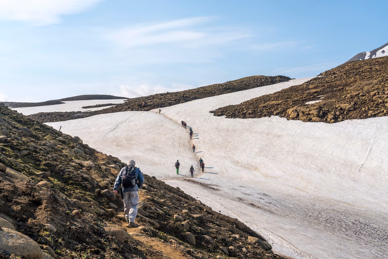
- Alpine/Highland routes: Remote tracks crossing snowfields and unbridged rivers; require strong fitness, self‑reliance, and sometimes river‑crossing technique.
- Glacier travel: Guide‑only unless you have technical mountaineering skills/equipment.
Planning & Safety Basics
- Check weather (wind, precipitation, temperature) and pick a route that matches the day’s conditions. Wind dictates much of your plan.
- Confirm road access to trailheads (gravel/F‑roads, closures, single‑lane bridges).
- Leave a trip plan with someone and carry a charged phone; consider a satellite messenger/PLB for remote routes.
- Pack layers for wet/cold even on sunny mornings. Turn back if forecasts or conditions worsen.
- Never step off marked paths on geothermal grounds—thin crust can collapse.
- River crossings: Unbuckle hip belt, face upstream, cross at a wide shallow section, use trekking poles, and link arms in groups. If in doubt, don’t cross.
Essential Gear (Year‑Round Layering)
Clothing
- Wicking base layer (merino/synthetic) • warm mid‑layer (fleece or light puffy) • waterproof/windproof shell with hood • hiking pants + waterproof over‑trousers • wool socks + spare pair • hat/beanie • Buff/neck gaiter • liner gloves + waterproof shell gloves.
Footwear
- Waterproof hiking boots/shoes with good grip; in shoulder season or long wet routes, consider gaiters.
Navigation & Safety
- Offline map/GPS + paper map & compass • headlamp (autumn–spring) • whistle • small first‑aid & blister kit • emergency bivy/survival blanket • power bank.
Extras
- Trekking poles • sunglasses & sunscreen • thermos and snacks • dry bags for electronics • midge net (Lake Mývatn/East in summer).
Winter add‑ons
- Insulated jacket/pants • microspikes or crampons appropriate to terrain • goggles • heavier gloves • extra warm layers.
Leave No Trace & Trail Etiquette
- Stay on marked paths and keep off fragile moss—footprints can last for decades.
- Pack out all trash, including tissues and food scraps.
- Use toilets where provided; otherwise follow local guidance (cat holes often discouraged in high‑use areas).
- Give way on narrow trails; step to the side on durable surfaces.
- Drones: respect local rules and closures; avoid wildlife and other hikers’ privacy/peace.
- Gates on farm tracks: leave them as you found them.
Day Hikes Worth Your Time
Mount Esja (Þverfellshorn) — near Reykjavík
Well‑marked mountain path with city and bay views; several turnaround points depending on fitness and weather.
Reykjadalur Hot River — Hveragerði
A moderate hike over geothermal hills to a warm river where you can bathe. Stay on paths; water and ground can be boiling close to the trail.
Glymur Waterfall — Hvalfjörður
Scenic canyon route to one of Iceland’s tallest falls. Expect stream crossings and narrow cliffside sections; not ideal in early spring snow/ice or in high wind.
Skaftafell National Park Loops — Vatnajökull
Options from easy walks to Svartifoss to longer circuits like Skaftafellsheiði/Kristínartindar for glacier panoramas.
Snæfellsnes Coastal & Crater Walks
Arnarstapi–Hellnar sea cliffs, Saxhóll crater steps, and Dritvík beach give a micro‑Iceland sampler in a single day.
Kerlingarfjöll — Hveradalir Geothermal Area
Colorful rhyolite ridges, steam vents, and snow patches even in summer. Conditions vary; check access.
Landmannalaugar Colored Mountains (day options)
Short loops to Brennisteinsalda/Bláhnúkur with epic rhyolite views; end with a soak in the hot spring creek at the camp.
Classic Multi‑Day Treks
Laugavegur Trail (Landmannalaugar → Þórsmörk)
Rhyolite mountains, obsidian deserts, hot springs, and river valleys. 3–4 days, hut or tent; add Fimmvörðuháls to continue over volcanic craters to Skógar (extra long day or split with a hut). Book huts well in advance.
Hornstrandir Nature Reserve (Westfjords)
Remote, roadless peninsula of sea cliffs and arctic fox habitat. Access by seasonal boats; fully self‑supported trekking with hut or tent options. Weather can be wild—plan conservatively.
Víknaslóðir “Deserted Inlets” (Eastfjords)
Network of coastal and mountain routes between tiny coves and colorful peaks; mix huts and camping with boat/shuttle logistics.
Askja & Ódáðahraun Variants (Highlands)
Volcanic deserts, lava cairn routes, and crater lakes. Logistics and navigation are more demanding; for experienced parties.
Huts, Camping & Logistics
- Mountain huts on popular routes must be pre‑booked; bring your own sleeping bag. Facilities vary; expect simple kitchens, bunks, and no showers in many.
- Highland buses operate seasonally to Landmannalaugar, Þórsmörk, and other hubs; schedules depend on road openings.
- Camping is widely available; use established campgrounds near trailheads and huts. Wild camping is heavily restricted—follow current regulations and local signage.
- Water is generally abundant and clean in uplands, but avoid collecting near farms or geothermal areas; when unsure, treat.
Wildlife & Environmental Notes
- Arctic terns defend nests with dive‑bombing; wear a hat and raise a pole/arm above your head as you pass calmly.
- Sheep and horses share tracks; pass slowly and close gates.
- Midges can be intense near lakes/east in calm weather—carry a head net.
Photography Tips on Trail
- Pack a rain cover and microfiber cloths; weather flips fast.
- Use wide lenses for big skies and foreground lava, and a light tele for wildlife and distant waterfalls.
- Golden hours can be midnight‑adjacent in summer—budget time for late light and extra rest the next day.